![]()
For the first time since 1995, scientists map where Madagascar must protect first, 18 million hectares, under its 30×30 Biodiversity Plan
LONDON, UNITED KINGDOM, June 24, 2026 /EINPresswire.com/ — During London Climate Week, Madagascar is releasing the results of a landmark scientific workshop that will guide the next decade of conservation action under its 30×30 Biodiversity Plan. In late March 2026, 70 participants, including 50 scientists across seven taxonomic groups, 70% of them Malagasy, completed the country’s first full scientific re-prioritization of terrestrial biodiversity since 1995. The result is a consensus map covering roughly 18 million hectares of priority land, about a third of the country, giving government, conservation organizations, communities, and funders a shared foundation for what to protect and where to act first.
Within those 18 million hectares, the workshop pinpointed where the scientific case is strongest. Areas independently flagged by three or more expert groups point to four kinds of near-term actions: roughly 2.7 million hectares for new protected areas, about 3.3 million hectares to extend existing ones, close to 2 million hectares of ecological corridors to reconnect fragmented landscapes, and 12.7 million hectares of zones that need to be quickly inventoried – and the results will feed in to the 30×30 actions. For the first time, the workshop also gave dedicated attention to freshwater ecosystems, identifying nine unprotected zones covering about 1.6 million hectares that are critical for water security and fish populations.
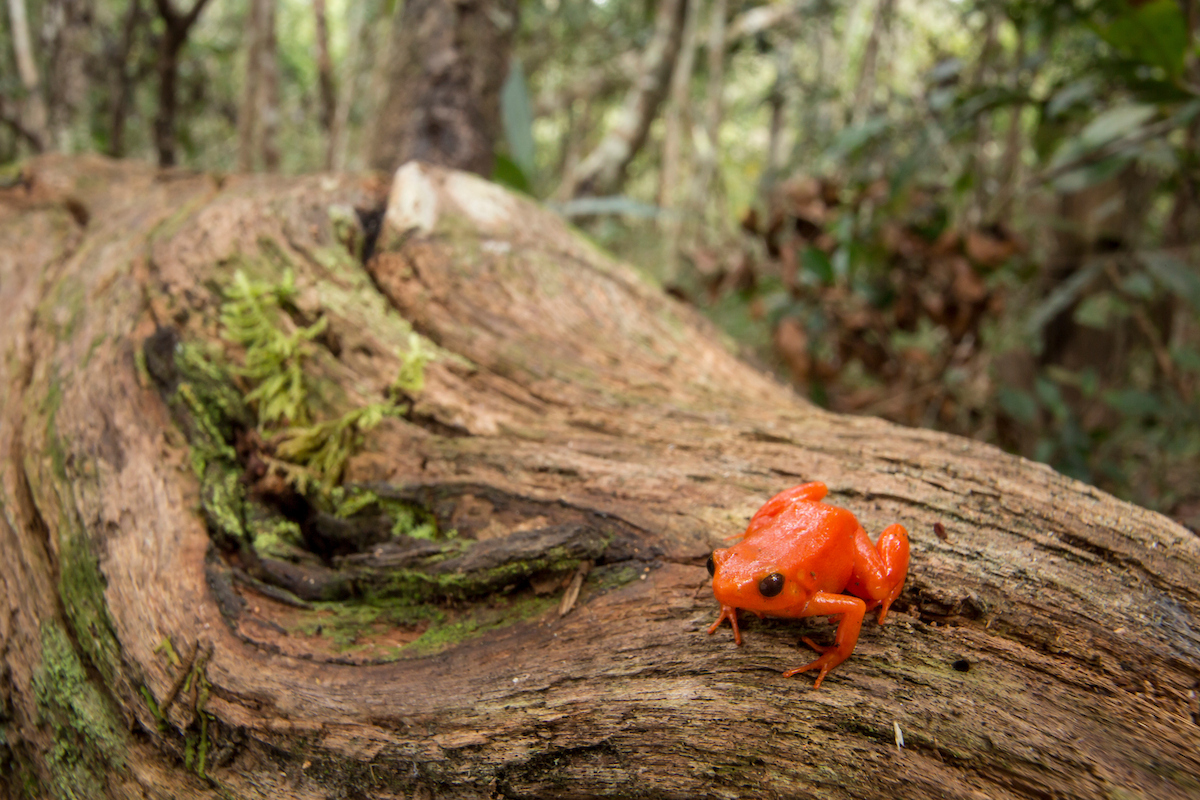
Madagascar covers just 0.4% of the world’s land but holds 5% of all species on Earth, 90% of which exist nowhere else. One hectare of forest lost in Madagascar has a greater impact on global biodiversity than almost anywhere on the planet. The last time scientists systematically mapped where protection was most needed was 1995. Thirty-one years later, the science has advanced while the pressures have intensified, making it critical to understand where to act and what to protect now.
“In my years working in Madagascar, I have never seen an exercise of this scale or rigor. We brought together three decades of new data and tools, from Madagascar and beyond, to create the most current picture possible of what needs protecting most,” said Professor Lily Arison Rene de Roland, lead scientist for the bird group at the workshop. “The gaps we identified are just as important as the sites themselves. They are an honest map of where the next discoveries are waiting to be made. We know more about the surface of the moon than we do about parts of one of the most biodiverse places on Earth. That should tell us something about where science needs to go next.”
The map’s blank spaces are a finding in their own right. A separate assessment of Madagascar’s vast and largely undocumented insect and invertebrate life reinforced the point, with most of its priority area falling in these same knowledge gaps. These zones will be the focus of urgent field surveys that feed directly into future protection decisions.
“What stood out to me from the workshop was not just the science, but who was doing it,” said Dr. Steven Goodman, MacArthur Field Biologist at Chicago’s Field Museum of Natural History and Association Vahatra, one of the principal workshop organizers and an author of the workshop report. “A generation of Malagasy scientists now leads this work, building on decades of international collaboration to produce something that is genuinely their own. That transition in scientific leadership is as significant as the findings in this report.”
The workshop is the latest milestone in an 18-month arc that has seen Madagascar move from political commitment to a validated, costed, nationally owned biodiversity plan. In February 2026, the government designated 21 new protected areas covering 1.82 million hectares, bringing the national total to 8.88 million hectares. In April 2026, Prime Minister Mamitiana Rajaonarison formally committed his government to the plan before conservation partners and funders in Washington, DC. Through it all, including a period of political instability, Madagascar’s commitment to this work has not wavered, carried forward by its scientists, communities, independent institutions, and national and international funders.
“For the first time in more than three decades, we know exactly where to focus our efforts to save Madagascar’s terrestrial biodiversity,” said Alain Liva Raharijaona, 30×30 Coordinator at Madagascar’s Ministry of Environment and Sustainable Development. “This workshop has given us that clarity, grounded in the best available science and collectively owned by Madagascar. Now we act on it.”
The findings now feed directly into a tiered implementation plan. The highest-confidence priority areas will be fast-tracked for protection over the next two years, while targeted field surveys begin filling the knowledge gaps that will guide action through the rest of the decade.
Madagascar is inviting partners, governments, foundations, and investors into a proven, nationally led conservation model built on independent institutions, transparent financing, and communities at its center. “It is often mistaken that communities living alongside and within these wild areas do not have a good understanding of their own wealth,” said Julie Razafimanahaka, Director of Madagasikara Voakajy. “Communities know their own biodiversity as much as any scientists. The results are great proof that priorities are aligned, and protection decisions are grounded in science backing up local knowledge. It makes all the difference.”
As London Climate Week convenes world leaders, funders, and policymakers to take stock of 30×30 progress, Madagascar’s answer is already clear. The country has spent 18 months doing the groundwork of mapping, prioritizing, and designating that turns a pledge into action. The question now is whether wealthier nations will match that ambition with adequate investment in one of the planet’s most irreplaceable natural systems.
“What this workshop has produced is something conservation rarely achieves: a single scientific picture that every actor can align around,” said James Deutsch, CEO of Rainforest Trust. “When government, NGOs, communities, and funders are all working from the same map, decisions get made faster, resources go further, and progress compounds. That unified foundation is what successful conservation is built on.”
As the report itself concludes, the unprecedented scientific consensus produced by this workshop underscores the scale of Madagascar’s conservation challenges and provides the clearest roadmap yet for meeting it.
The workshop was made possible thanks to the support of Conservation Allies, Re:wild, Hempel Foundation, Rainforest Trust, and the Campaign for Nature.
Maps and images available here.
###
About Madagascar’s 30×30 Biodiversity Plan
Madagascar’s 30×30 Biodiversity Plan is a nationally owned, science-based, and costed strategy to protect 30% of the country’s terrestrial and marine areas by 2030. In February 2026, Madagascar designated 21 new protected areas covering 1.82 million hectares, bringing the national total to 8.88 million hectares. Three pilot conservation landscapes are already operational. The plan targets $150 to 220 million mobilized annually for conservation financing. It has been developed with the support of SPACES, Campaign for Nature, the High Ambition Coalition for Nature and People (HAC), Rainforest Trust, and other partners. www.madagascar30x30.com
Notes to editors
The 30×30 Biodiversity Plan aims to protect 30% of Madagascar’s land and marine ecosystems by 2030. The workshop was the first full re-prioritization of Madagascar’s terrestrial biodiversity since 1995, drawing on seven taxonomic groups: plants, lemurs, birds, reptiles and amphibians, other mammals, freshwater fish and aquatic plants, and arthropods.
Unlike previous efforts, which focused principally on forests, the 2026 workshop asked participants to consider all terrestrial ecosystems for conservation action.
The total priority footprint identified is roughly 18 million hectares. The figures below are areas of strongest scientific agreement, independently identified by three or more expert teams. The first three are protection actions and the fourth is a research priority; these areas overlap on the ground and should not be added together:
• New protected areas: about 2.7 million hectares
• Extensions to existing protected areas: about 3.3 million hectares
• Ecological restoration corridors: about 2 million hectares
• Priority research zones (high biodiversity value, data still incomplete): about 12.7 million hectares
• Unprotected freshwater zones (analyzed separately): about 1.6 million hectares
The full scientific report “A scientific basis for advancing terrestrial conservation priorities of Madagascar” is available here for download.
Rose Olwell
Greenhouse Agency
email us here
Legal Disclaimer:
EIN Presswire provides this news content “as is” without warranty of any kind. We do not accept any responsibility or liability
for the accuracy, content, images, videos, licenses, completeness, legality, or reliability of the information contained in this
article. If you have any complaints or copyright issues related to this article, kindly contact the author above.
![]()
Media gallery